Gouvernement
National crop monitoring platform: 25,000+ plots tracked daily
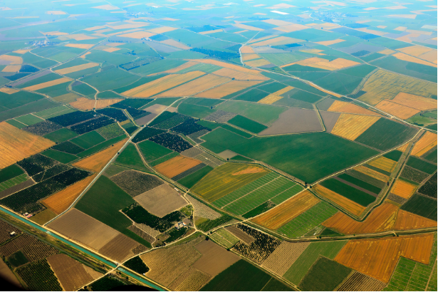
How a national agriculture engine combines satellite imagery and field surveys to monitor crops at scale across Africa and North America.
2 min read
Read articleField-proven deployments for governments, farmers, cooperatives and insurers across Africa, Canada and the United States.
How a national agriculture engine combines satellite imagery and field surveys to monitor crops at scale across Africa and North America.

Field teams identify crop diseases and pests via smartphone; centralized alerts enable coordinated response within hours, not weeks.

Spatialized performance and risk indicators refine agricultural credit assessment with verifiable plot-level data instead of self-reported yields.

African cooperatives digitize harvest flows, quality checks and buyer certificates to secure premiums and meet export traceability requirements.
Replace paper agricultural censuses with GPS-tagged mobile forms, validation rules and live dashboards for national statistics offices.

Deep learning models delineate field boundaries from satellite imagery so governments register parcels faster and insurers validate insured areas.
NGOs and microfinance institutions use plot-level productivity signals to extend credit to smallholders previously excluded from formal finance.
Vegetation and soil moisture indicators trigger drought alerts so farmers and advisors act before irreversible yield loss.
OEMs and distributors embed AgroPure analytics via REST APIs or deploy a branded national platform without building GIS infrastructure from scratch.
Index-based policies trigger payouts when vegetation or rainfall thresholds are breached, reducing loss adjustment costs and speeding farmer compensation.